People and Demographics
Total Population: 6,914
Under 18: 2,024
65 and Over: 692 More Data on People & Demographics: Trends |
RelatedData
Families and Households
Single Householder with Children: 856+/-173 More Data on Families and Households: Trends |
Related Data
Education and Literacy
College Graduates: 3.9%+/-6.1%
Completed High School: 63.5%+/-5.3% More Data on Education and Literacy: Trends |
Related Data
Employment and Income
Estimated Median Household Income: $26,287+/-$11,103
Families in Poverty: 39.1%+/-11.1%
Percent of Labor Force Unemployed: 28.2%+/-8.0% More Data on Employment and Income: Trends |
Related
Data
Housing
Housing Units(#): 2,996
Renter-Occupied Housing Units: 2,169+/-198
Owner-Occupied Housing Units: 460+/-119
Structures Built Before 1950 (%): 51.0+/-6.7% More Data on Housing: Trends |
Related Data
Public Safety and Crime
Total Crimes Against Persons in 2011: 171
Total Crimes Against Property in 2011: 247 More Data on Public Safety and Crime: Related Data
Transportation
Average Commute Time (in minutes): 23+/-5 More Data on Transportation: Related Data
Special Notes on Neighborhoods and NRZs:
Learn about the
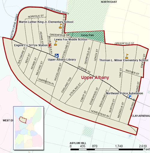
Name, Boundary and Location of each Neighborhood
and NRZ in Hartford.View the
Census Tract and Block Map
for the
Upper Albany
NRZ.The NRZ listed below covers all or some of the same geographic area as the Upper Albany neighborhood: Upper Albany